GPS, short for Global Positioning System, devices are everywhere.
The tech needed to give you a quick readout on your location anywhere in the world is smaller and cheaper than ever.
GPS, and the navigating efficiency it enables, is truly one of the wonders of modern life.
Your phone, your watch, even your fitness tracker – all these things can take advantage of this satnav (Satellite Navigation) technology.
Getting lost is obsolete if you have one of these devices in your pocket.
But, there’s still some reasons to use a handheld GPS device.
Especially in a tactical or survival environment.
That’s what we’ll talk about in this article.
Here’s the gear we are going to cover.
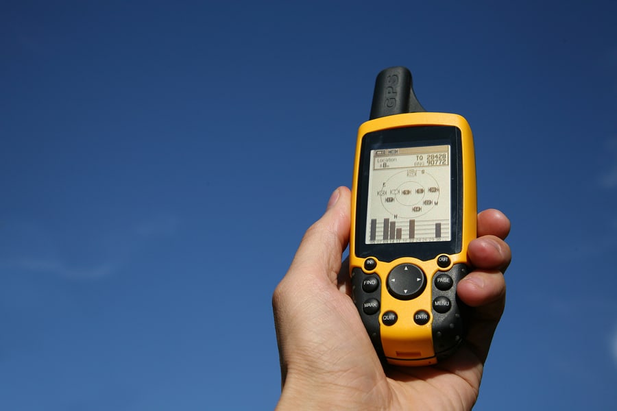
Handheld GPS vs Smartphone – The advantages of hand held GPS
First, let’s cover this.
Why would you even want an expensive standalone GPS?
Can’t you just rely on your smartphone, smartwatch, or other consumer device?
Maybe – and maybe not.
Let’s start with some realistic factors.
Your smartphone (and smartwatch) has utterly miserable battery life. (Partially this is because they pack so much processing power to run apps.)
Most phones can be actively used for a few short hours at the most – and then they are dead.
And, many phones (we’re looking at you Apple) don’t have replaceable batteries.
A non-specialized smartwatch is likely in the same boat – and probably even worse – because the battery is so much smaller.
These modern consumer devices are a lot of fun – in civilization.
But, in the back country their limitations become apparent.
Smartphones are simply not a robust survival tool because of the battery limitations.
They are also relatively fragile devices – they cannot withstand drops or other physical damage.
Many are not acceptably waterproofed (although this is changing with the latest devices, but the fact is most phones are not sufficiently robust for water immersion.
Lastly, the very nature of smartphones means they are constantly broadcasting your precise location via radio signals.
After all, a cell phone is a small radio. And in order for the cellular network (consisting of thousands of “cells”) to work, the network has to know the approximate physical location of the phone at all times.
This is how the cell network knows to route incoming calls to the appropriate cell tower (radio transmitter.)
How about airplane mode?
Yes, that’s fine. But you have to remember to keep the device in that mode.
Here’s another advantage – handheld GPS are optimized for backcountry use.
There’s a variety of devices with high resolution topographic map options available (aka topo maps.)
We’ll assume in a tactical or survival situation you are going off road most (if not all) of the time.
And in those situations, a topo map is going to be a hell of a lot more useful than what Google Maps gives you on your smartphone.
One last point.
There’s a saying: two is one and one is none.
If you’ve got a smartphone and a handheld GPS – you have two potential ways to navigate in a serious situation.
The handheld GPS can be your backup when that fragile smartphone dies.
OK – I hope you get the point – the handheld GPS is not extinct. It’s the right tool for many jobs.
Let’s look at some gear.
Handheld GPS – Garmin GPSMAP 64st
The Garmin GPSMAP 64st (Buy on Amazon) is one example of a handheld GPS.
What do we like about it?

Sunlight readable color display – we consider this a must.
Topo maps are just much easier to use with a nice high resolution color display. Bonus points for it being bright enough to use in bright sunlight. The resolution is 160×240 pixels – which sounds not that great compared to your smartphone – but the lower resolution is one of the reasons these units have much, much better battery life.
It’s IPX7 rated waterproof – that means it will survive up to 30 minutes total water immersion at up to 1 meter depth.
It can use GPS signals from the US satnav system – or GLONASS signals from Russia’s version of satnav.
This model also has the ABC sensors – Altimeter/Barometer/Compass as well. We definitely recommend that for anyone looking for a navigation tool.
With 8 GB of storage you already have preloaded topo maps for all of the US, but you an also access satellite imagery for the areas you need. You preload this via the included Wifi connectivity.
It can also use swappable SD cards – for the ultimate in storage. Use this to max out the amount of pre-loaded satellite imagery you think you’ll need.
Lastly, it has ANT+ compatibility so it can work with heart rate monitors and other fitness type gear.
Use AA batteries or the included rechargeable NiMH battery pack.
Battery life is 16 hours – but remember – you can (and will) swap batteries and be up and running again in no time flat.
Lastly, it weighs 8 ounces.

- Sunlight Readable 2.6 inches color display. Display size : 1.43 x 2.15 inches and 2.6 inch diag (6.6 centimeter). Battery life : 16 hours. Water rating IPX7.Control Method:Touch.Special Feature:bluetooth.
- Expanded Internal Memory 8GB.Display resolution 160 x 240 pixels. Interface: high speed USB and NMEA 0183 compatible
- DUAL BATTERY SYSTEM Use with 2 traditional AA batteries (best with Polaroid AA batteries), or the optional rechargeable NiMH battery pack that can be charged while inside the device.Weight 8.1 ounce (230 grams) with batteries
- Receive Smart Notifications* and pair with optional ANT+ sensors, such as heart rate monitor, Tempe temperature sensor, speed/cadence, or use to control your VIRB action camera (64s/64st only)
- Wirelessly upload data to Garmin Connect and view on smartphone, plus share activities as they happen with Live Track (64s/64st only). 3 axis compass with barometric altimeter.Routes:200
Garmin GPSMAP 66st
Step up to the Garmin GPSMAP 66st (Buy on Amazon) model of handheld hiking GPS and you’ll get quite a few more bells and whistles.
First of all, it’s got a great big color display (3″).

It’s billed as having multi-GNSS (Global Navigation Satellite System) support – that means it can utilize GPS, GLONASS (Russia), and the EU’s Galileo satellite systems.
That’s the most flexibility you can have. While the GLONASS and Galileo systems aren’t as complete as the US GPS system – it’s good to have that as a backup.
This one also has 16 hour battery life – with replaceable batteries.
It has all the features of the other Garmin unit – ABC sensors, SD Card, Topo maps preloaded, satellite imagery, and more.
This unit is unique in that it also includes a handy LED flashlight and SOS beacon function.

- Premium GPS handheld with Birdseye Satellite Imagery subscription and TOPO maps
- Large, 3” sunlight-readable color display for easy viewing. Display size - 1.5 W x 2.5 H inch (3.8 x 6.3 cm); 3 inch diag (7.6 cm)
- Multiple Global Navigation Satellite Systems (GNSS) support to track your travels in more challenging environments than GPS alone plus three-axis compass and barometric altimeter
- Access to Birdseye Satellite Imagery with direct-to-device downloads and no annual subscription and preloaded TOPO U.S. and Canada maps
- Expanded wireless connectivity supports Active Weather for up-to-date forecasts and animated weather radar and Geocaching Live for mobile syncing and updates
Garmin eTrex 22x
Need a cheaper option?
The Garmin eTrex 22x (Buy on Amazon) is billed as a rugged handheld GPS navigator.
It is one of the most affordable handheld GPS that includes a color screen.

What do you give up?
The screen is physically smaller at 2.2″ but is still relatively high resolution at 240 x 320 pixels.
It still has 8GB of storage (and SD Card slot) and has topo maps preloaded.
It’s missing some of the bells and whistles like the ANT+, Bluetooth connectivity, etc. – but honestly those are not important for navigating the backcountry.
In GPS mode the 2 AA batteries can last up to 25 hours.


- Explore confidently with the reliable handheld GPS
- 2.2" sunlight-readable color display with 240 x 320 display pixels for improved readability
- Preloaded with Topo Active maps with routable roads and trails for cycling and hiking
- Support for GPS and GLONASS satellite systems allows for tracking in more challenging environments than GPS alone
- 8 GB of internal memory for map downloads plus a micro SD card slot.Battery life: up to 25 hours in GPS mode with 2 AA batteries
Garmin Foretrex 401 Waterproof Hiking GPS
Want the lightest, most compact GPS?
Something like the Garmin Foretrex 401 Waterproof Hiking GPS (Buy on Amazon) might do the job.
This is meant to be worn on your wrist – so it is small and light.
The display is a simple LCD – and there’s no topo maps.

You can USB connect this to your PC or Mac to plan a route – and store the relevant waypoints.
But, that means it’s cheaper and has better battery life (17 hours).
It has an Altimeter and Compass
It takes 2 AAA batteries.

- Features high-sensitivity GPS receiver with HotFix for improved performance and reception in heavy tree cover or deep canyons
- Keeps track of routes, tracks and waypoints, and heart rate with add on heart rate monitor (sold separate). Uses standard AAA batteries. 2 required.
- TracBack feature retraces user's path on the easy-to-read LCD display;Display resolution 100 x 64 pixels;Battery life Up to 17 hours in GPS mode;Track Log 10000. Display size : 1.42 x 0.91 inches
- Supports dual position readout so user can view current location in multiple formats. Audible tones. Hold the compass level when navigating to ensure maximum accuracy
- Features trip computer, sunrise/sunset times, hunting/fishing information, electronic compass and barometric altimeter
Military GPS Devices
Two popular GPS devices used by the US military are the Precision Lightweight
GPS Receiver (PLGR-96) and the Defense Advanced GPS Receiver (DAGR) AN/PSN-13.

These have a lot of features the military finds useful.
These devices are optimized for determining target coordinates (close air support) and sighting artillery to a target. The DAGR can also find GPS jamming sources.
These are also protected to a degree against GPS spoofing, using a feature called Selective Availability Anti-Spoofing Module (SAASM.)
These devices aren’t available on the consumer market – and they are pretty complicated to use too.
As such, we’re not going to cover these devices here.
Urban Maps – Where the Smartphone Rules
Now, having outlined the advantages of the handheld GPS – there is one arena where the modern smartphone rules.
In an urban environment you can’t beat the city and street level maps available on your smartphone (at least for most major cities in some of the world.)
Just remember your phone is a small radio transmitter…
Handheld GPS devices – In Summary
The handheld GPS device is far from obsolete.
These ruggedized survival devices are optimal for backcountry use – where topo maps and multi-day battery life are essential.
For serious situations (like tactical environments or survival) use one as your primary navigation – or as a bulletproof backup for that fragile smartphone.
Lastly, if you are going to use your fragile smartphone like a GPS unit – at least be sure to protect it in a military grade phone case.
References
Defense Advanced GPS Receiver (DAGR) Product brochure – from Rockwell Collins.
GNSS Jamming and Spoofing, aka Galileo’s Authentication Algorithm Part 3
Photo Credits
Some photos are property of the manufacturers.
The appearance of U.S. Department of Defense (DoD) visual information does not imply or constitute DoD endorsement.

Last update on 2024-06-26 / Affiliate links / Images from Amazon Product Advertising API